
Tan Long Islet (Dragon Islet) – A Corner Of Mekong Delta
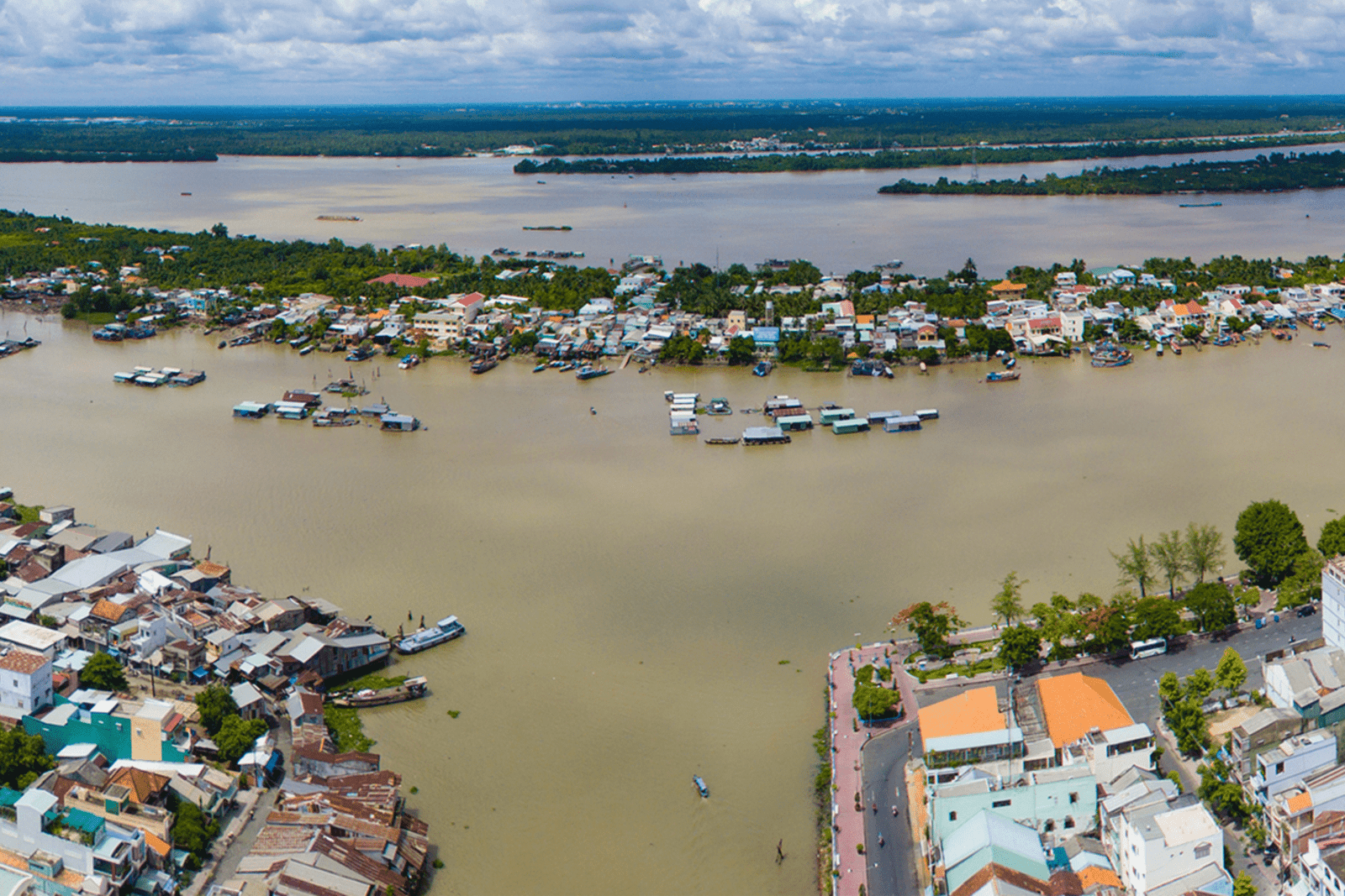
Con Long – better known locally as Con Tan Long or “Con Rong” (Dragon Islet) – is a mid‑channel island in the Tien River directly opposite downtown My Tho City, Tien Giang Province. Though small compared with the surrounding plain, the islet is a compact portrait of the upper Mekong Delta: orchards pressed up against river revetments, fish cages swinging in the current, and family boatyards whose timbers smell of brine and resin. In daily usage, “Con Long” refers to the landform itself; historically, the administrative unit covering the islet was Tan Long (commune, then ward). In 2025, as part of Vietnam’s nationwide rearrangement of commune‑level units, Tan Long Ward was merged with Wards 1 and 2 to form the new My Tho Ward, but the physical island and the local name Con Tan Long remain in common use.
Visitors remember the proximity first. From the My Tho riverfront, a short ferry or hired wooden boat carries you a few hundred meters across the bright braid of the Tien River; within minutes you step from city pavement into a riverscape of palms, longan trees, and low sheds where engines are stripped and planks are planed.

Names and identity
The islet’s names carry its meaning. “Con Long” is the geographic term. “Con Rong” – Dragon Islet – is the nickname that ties the place to river folklore. Administratively, the area was long known as Tan Long, elevated to Tan Long Ward in 2003. In tourism, Con Long is presented as one of the four neighboring islets commonly called the “Tu linh” (Four Sacred Animals): Long (Dragon-Con Long), Lan (Unicorn-Thoi Son), Quy (Tortoise-Con Quy), and Phung (Phoenix-Con Phung). Together they sit astride the Tien River where Tien Giang meets Ben Tre.
Location and size
Con Long lies mid‑stream right in front of My Tho. The islet’s commonly cited land area is about 273 hectares (≈ 2.73 km²), a figure repeated in multiple gazetteers. Within the “Tu linh” set, Thoi Son/Con Lan is the largest at about 1,200 ha; Con Quy is roughly 170 ha; and Con Phung a little over 50 ha. These numbers are useful for orientation and for understanding how the four islets fit together along the same reach of the river.
A methodological note helps reconcile sources. When Tan Long Ward was established in December 2003, the Government’s founding decree recorded “330 hectares of natural area and 4,723 inhabitants” for the ward. The difference between ≈273 ha (the land body most people mean by “Con Long”) and 330 ha (the 2003 administrative figure) reflects boundary definitions – physical islet vs. ward delimitation that can include a belt of water surface – and the reality that river islands in the Mekong slowly shift. Both numbers belong to the record; in practice, “about 273 ha” describes the present landform, while “330 ha” is a legal snapshot tied to the 2003 upgrade.
River‑made origins and early memory
Delta islands accrete. In local oral history, the sandbar that became Con Rong surfaced as a small shoal around the late eighteenth century (often dated to about 1788). By 1872, the shoal had grown into an island, initially clothed in pioneer species such as river tamarisk, mangroves, and nipa palms. Later accounts mention a powerful river creature (“ong Cu”) and tell of a Dinh Tuong-era landholder crossing to claim the new ground before the French era; whatever the embellishment, the core is plain: this is a place literally made by the river’s sediment and settled by people willing to test the water.
A difficult episode shadows the memory too. In 1958, during the late‑colonial/early‑Republic period, a small leprosy camp associated with Binh Duc was set up on the island and operated until 1971, after which patients were moved to Quy Hoa (Quy Nhon). The harsh nickname “Con Cui” dates from that time. In the decades that followed, poor families without land on the mainland moved out to the islet, establishing the mixed livelihoods-fishing, aquaculture, fruit growing-that define the community today.
See more: Thoi Son Islet (Lan Islet) – Touch the Soul of the Mekong
Administrative evolution (to 2025)
After 1975, Tan Long Commune belonged to the new Tien Giang Province together with My Tho. On 9 December 2003 the Government issued Decree 154/2003/ND‑CP, upgrading Tan Long to Tan Long Ward of My Tho City with 330 hectares and 4,723 residents recorded in the decree.
As part of the 2023-2025 national program to streamline commune‑level units, My Tho consolidated several wards. In 2024, Ward 7 was merged into Ward 1; official provincial reporting at the time still referenced adjacent Tan Long. In 2025, press and legal summaries reported that Ward 1, Ward 2, and Tan Long Ward were merged to form the new “My Tho Ward.” For visitors, this matters mostly for paperwork; the island itself remains the same physical place and the local name Con Tan Long endures.
Landscape and environment
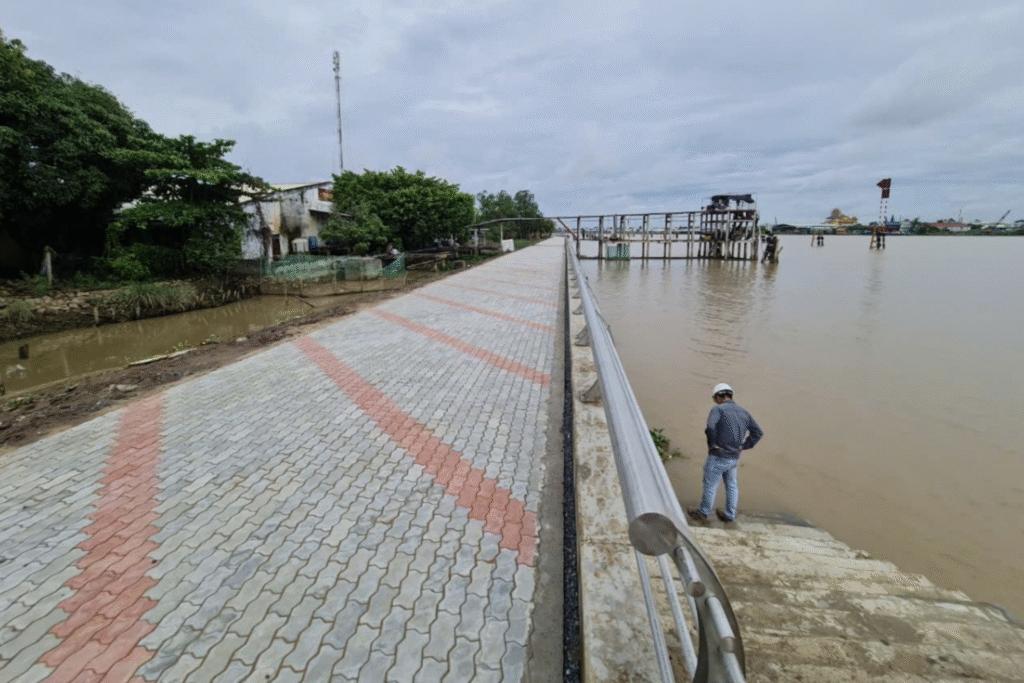
Con Long’s landscape is the river woven into gardens. The ring levee and internal lanes have been progressively hardened; nearly all neighborhood roads are now concrete, making it easier for farm carts and visitors. Coconut palms and longan anchor most plots, interspersed with banana, jackfruit, guava, and herbs. Along the banks you will see lines of fish cages bobbing in the current; inside the creeks are clusters of low‑roofed sheds where wooden fishing boats and aluminum skiffs are maintained or rebuilt.
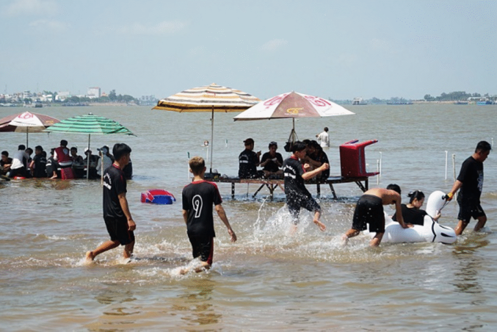
Rivers give and rivers threaten. Like other mid‑channel islets, Con Long lives with bank erosion, seasonal flooding, and occasional salinity pulses that stress certain crops. Residents adapt by re‑vetting the banks, switching varieties, keeping floors raised, and diversifying household work. The same long‑term accretion that created the island also continues to reshape it; shoreline plots appear and disappear, and the exact contour of the island is a conversation rather than a fixed line.
Economy: from river to market
Aquaculture and capture fisheries. The island’s households work both sides of the water’s ledger. In 2020–2021, provincial reporting counted about 169 fish‑farming cages (predominantly tilapia, locally “ca dieu hong”) on the river around the islet, with annual harvests in the neighborhood of 4,469 tons. Alongside this, a modest inshore fleet of roughly 32 fishing vessels operates from the My Tho port system, with reported combined catches in the 15,000‑plus ton range per year (catches are landed and recorded on the mainland). Exact figures vary with seasons and markets, but they show how river protein remains a pillar of livelihoods.
Horticulture. Fruit gardens complement the water economy. Longan enjoys the best local reputation; coconut is both a steady cash crop and a cultural motif (yard fences made of coconut logs are a common sight). Many smallholders combine fruit with vegetables, flowers, and beekeeping, supplying My Tho, nearby Ben Tre, and the tea‑and‑fruit tasting stops typical of the Delta.
Boatyards and repair. Con Long is known for several small boatyards and repair sheds. Official notes mention around five facilities actively repairing 300‑plus vessels per year, with annual revenue in the low billions of VND-a classic micro‑enterprise sector: family‑run, skill‑rich, and tightly tied to seasonal fishing cycles.
Household services and river‑city linkages. Because the islet sits opposite a provincial capital, many residents run guesthouses, small eateries, convenience shops, ferries, and transport services, while commuting to the mainland for schooling and formal employment. The short ferry ride is not just a convenience; it is the islet’s economic artery, carrying goods, students, workers, and visitors both ways all day.
Tourism: part of the “Tu linh” circuit-on its own terms
Con Long forms the Tien Giang half of the “Tu linh” together with Thoi Son (Con Lan); the other two – Con Quy and Con Phung – are in Ben Tre across the channel. Thoi Son, at about 1,200 ha, is the established mass‑tourism hub (rowing sampans, bee farms, traditional music), while Con Phung hosts heritage attractions related to the 20th‑century “Coconut Religious Sect.” Con Long offers a quieter complement: river views back toward My Tho’s skyline, homestyle lunches, garden walks, a look at fish‑cage aquaculture, and the chance to watch boat repair up close. It feels more lived‑in than staged.
Responsible visiting matters on a small island. Travelers should (1) respect private orchards and fish cages – ask before entering; (2) minimize single‑use plastics and take trash back to the mainland; (3) buy locally (fruit, sweets, coconut products); and (4) ride with licensed boats/ferries and wear lifejackets on small craft.
Community and culture
Mekong Delta culture flows through amateur don ca tai tu music, river festivals, family altars, and the quiet rhythm of morning markets. On Con Long, community life is woven around neighborhood lanes, temple and church activities, and fishing/harvest calendars. The name “Tan Long” – literally “New Dragon” – reflects both pride in the Dragon motif and the community’s sense of renewal during the urban‑ward years after 2003.
Infrastructure and access
Access. Visitors typically board a public ferry or chartered boat from the My Tho riverfront (for example along Trung Trac Street). Crossings take only a few minutes, with frequent departures in daytime; at night, services thin out. When river levels are high or during storm warnings, operations may pause – check locally on the same day.
Internal roads. Over the last two decades, the ward/island leadership and residents have upgraded intra‑islet roads, concreting lanes and improving bank protections. Two access roads at the “head” and “tail” of the islet were upgraded in the late 2010s/early 2020s with joint state‑community funding – modest projects that make a practical difference to produce logistics and everyday mobility.
Public services. As part of the My Tho urban area, residents benefit from city‑level schooling, healthcare access on the mainland, and administrative services. After the 2025 ward merger, administrative windows for residents are handled under the new ward structure; details such as office location and forms are best confirmed in My Tho, as procedures are being adjusted during the consolidation.
Environment and resilience
Like many alluvial islets, Con Long sits just above the waterline. Climate variability-intense upstream floods in some years, dry‑season flow reductions and salinity in others-compounds bank erosion and soil stress. Local practice offers a quiet resilience: bank planting and revetments, elevated floors, backup water storage, and diversified livelihoods. The mixed economy (fish + fruit + services) also spreads risk.
Practical orientation for first‑time visitors
When to go. The dry season (roughly December-April) offers clearer water and easier crossings; the wet season brings greener orchards and cooler afternoons.
How long. A half‑day is enough for a first look; a full day lets you pair Con Long with Thoi Son or cross into Ben Tre’s islets.
What to pair. Combine with the My Tho riverfront market, Vinh Trang Pagoda, and a boat loop past the river confluence.
What to taste. Coconut‑based sweets, longan, river fish (grilled tilapia, sour soup), and the honey‑tea tastings popular across the Delta.
Etiquette. Ask before photographing people at work; tip boat handlers and music groups; keep to paths in orchards.
Why Con Long matters
When big deltas are discussed, small places are easy to miss. Yet Con Long is a delta microcosm: created by the river, lived by fishers and gardeners, linked tightly to a nearby city, and carried forward by practical resilience. Spreadsheet labels may change-273 ha here, 330 ha there, a new ward name in 2025-but the essence persists: a community poised between river and city, making a home out of water and silt.
♥ Saigonbiketours – Food Tour In Saigon ♥


